Accessing data from the Parkes 2.4 GHz Survey of the southern Galactic Plane
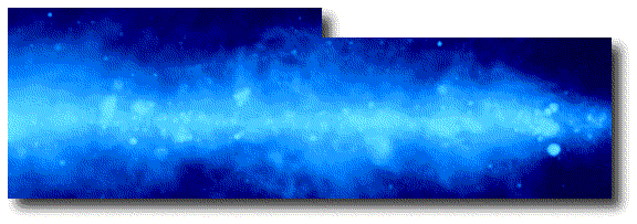
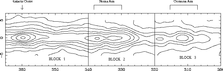
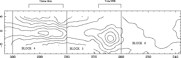
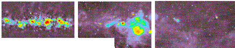
The survey covers 127° of Galactic longitude. For convenience, this is broken into six blocks, each of which is approximately 20° in length. The arrangement of these blocks is shown below, with the Plane broken into two sections of 3 blocks each. Click on any part of this sketch to go to the block you wish to examine. Alternatively, click on any of the colour total-power images (just below the sketches) to go to your chosen block.
On the following pages, you will be confronted with five possible images to download. These are:
Total-power image (small-scale component)
For ease of representation, the total-power data were "split" into small-scale and large-scale components. The small-scale image contains objects and structure less than about 2° in size. The purpose of this was to separate the smaller, interesting sources from the bright, non-thermal "ridge" of emission which could otherwise mask such objects. Note that, although blocks 5 and 6 are essentially devoid of bright, "ridge" emission, the identical filtering has still been applied.
Total-power image (large-scale component)
The large-scale component of the data contains structure on scale-sizes of the order of several degrees and larger. Note that the complete total-power images can be reconstructed by simply adding the small- and large-scale components.
Stokes-Q and Stokes-U images
The Stokes-Q and Stokes-U data, respectively. These images are calibrated such that the polarisation position-angles correspond to the electric vector of the received radiation, and are given in degrees "east" of Galactic "north". That is, 0° corresponds to an electric vector perpendicular to the Plane. As the angle increases, the vector rotates anticlockwise. This is of course a position-angle relative to the Galactic pole.
Angle-shift image
However, we recognise that many people will want to transform the images into Equatorial coordinates. Unfortunately, no software package I have yet come across can transform the vector angles when regridding to another coordinate system. Thus, your transformed Q and U data will yield vector orientations which represent position-angles relative to Galactic north, when in fact you almost certainly want position-angles relative to Equatorial north.
These angle-shift maps allow the move between these two commonly used coordinate systems to be made easily. To transform the vector angles from "position-angle relative to the Galactic pole" to "position-angle relative to the Equatorial pole", simply subtract the appropriate angle-shift map from your vectors. The values contained within these angle-shift maps are in degrees, rather than radians.
FITS notes
The FITS files were produced with the data reduction and analysis package Miriad.
The regions of the survey containing no data are not blanked using any "magic blanking" number, but are simply left as zeroes. This is because Miriad's blanking follows the AIPS convention of using NaN to represent blanked regions, which makes programs such as SAOImage and the NOD2 system dump core.
Please note
These data and images were obtained by National Facility telescopes and equipment. All of the images and data obtainable from these pages are copyright. As such, they may be freely copied for personal and scientific use, but may not be distributed without appropriate acknowledgment of the ATNF. None of these images or data may be distributed for profit in any manner.
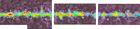
The total-power data from these blocks is shown below, with each block corresponding to that of the sketch above. Click on the colour image of the block you wish to examine.
Roy Duncan (duncan@atnf.csiro.au) Last updated: 10th August, 1999